مسیرهای ترانزیتی جایگزین به خلیج فارس از طریق ایران: راهنمای کامل انتخاب مسیر
ایران در محل اتصال جغرافیایی بین آسیای مرکزی، قفقاز، آسیای جنوبی و خلیج فارس قرار دارد. برای هر شرکت حمل و نقل، فوروارد یا برنامهریز لجستیکی که محمولهها را به سمت بنادر خلیج فارس منتقل میکند، این موقعیت اهمیت دارد زیرا وابستگی به حلقههای دریایی طولانیتر یا جایگزینهای تک کریدوری شلوغ را از بین میبرد. درک مجموعه کامل مسیرهای ترانزیت جایگزین به خلیج فارس از طریق ایران – نه فقط یک خط ترجیحی – چیزی است که برنامهریزی مسیر را از حدس زدن مسیر متمایز میکند.
به عنوان یکی از پرکاربردترین کریدورهای منطقه، ترانزیت آسیای مرکزی از طریق ایران، اقتصادهای محصور در خشکی مانند ازبکستان، تاجیکستان و قزاقستان را از طریق گذرگاههای مرزی شمال شرقی ایران به خلیج فارس متصل میکند.
این راهنما به عنوان یک منبع پشتیبانی تصمیمگیری، و نه یک تبلیغ برای فروش، تهیه شده است. این راهنما، کریدورهای اصلی، مرزها و زیرساختهایی که هر یک به آن متکی هستند، تفاوت بندرعباس و چابهار به عنوان بنادر پایانی و مقایسه گزینههای جادهای، ریلی و چندوجهی را بسته به نوع بار، مبدا و فصل، ترسیم میکند.
با توجه به پیچیدگی عبور از مرزها و نقل و انتقالات چندوجهی، اکثر بازرگانان بینالمللی برای مدیریت کامل این فرآیند به یک شرکت حمل و نقل معتبر در ایران متکی هستند.
معنای واقعی «مسیرهای حمل و نقل جایگزین» در این زمینه چیست؟
وقتی از مسیرهای جایگزین به خلیج فارس از طریق ایران صحبت میکنیم ، منظورمان کریدورهای زمینی و چندوجهی است که محمولهها را از مبدأهای محصور در خشکی یا از نظر جغرافیایی غیرمستقیم – آسیای مرکزی، قفقاز، افغانستان، پاکستان، هند و غرب چین – به خاک ایران و سپس به بندری رو به خلیج فارس برای حمل و نقل دریایی یا برعکس، منتقل میکنند.
Our expert logistics team is ready to deliver tailored strategies, efficient routes, and professional support.Looking for a trusted solution for international transport and transit of goods via Iran?
Contact us on Telegram today for dedicated consultation and reliable services.
این مسیرها نسبت به دو چیز «جایگزین» هستند:
- مسیرهای دریایی طولانیتر که کاملاً از ترانزیت ایران اجتناب میکنند (مثلاً مسیرهای دریایی اطراف شبهجزیره عربستان یا از طریق کانال سوئز).
- وابستگیهای تککریدوری ، مانند مسیرهایی که منحصراً برای محمولههای آسیای مرکزی یا افغانستانِ محصور در خشکی، به بنادر پاکستان (کراچی/گوادر) متکی هستند.
در عمل، انتخاب از میان مسیرهای ترانزیتی ایران به بنادر خلیج فارس، مسئلهای است که به تطبیق جغرافیای مبدا، نوع بار و میزان ریسکپذیری با ترکیب مناسب گذرگاه مرزی، روش حمل و نقل و بندر بستگی دارد.
مسیرهای اصلی ترانزیت جایگزین به خلیج فارس از طریق ایران
مسیر ۱: آسیای مرکزی به خلیج فارس از طریق ایران
این کریدور، قدیمیترین کریدور است. محمولههایی که از ازبکستان، ترکمنستان، قزاقستان، قرقیزستان و تاجیکستان سرچشمه میگیرند، از طریق ترکمنستان به سمت جنوب و شمال شرقی ایران حرکت میکنند.
- گذرگاه های مرزی کلیدی: سرخس (راه آهن و جاده)، اینچه برون، لطف آباد، باجگیران
- زیرساختهای اصلی: راهآهن سرخس-مشهد و خط آهن قزاقستان-ترکمنستان-ایران (اوزن-برکت-گرگان) که در سال ۲۰۱۴ تکمیل شد و به آسیای مرکزی امکان دسترسی مستقیم ریلی به خاک ایران را بدون عبور از روسیه داد.
- مناسب برای: کالاهای فله (غلات، پنبه، کود)، مواد معدنی و تجهیزات صنعتی که در آنها اقتصاد ریلی بیش از سرعت اهمیت دارد.
- بندر مقصد معمول: بندرعباس، به دلیل ظرفیت جابجایی کانتینر و فله و اتصالات فیدری برقرار شده.
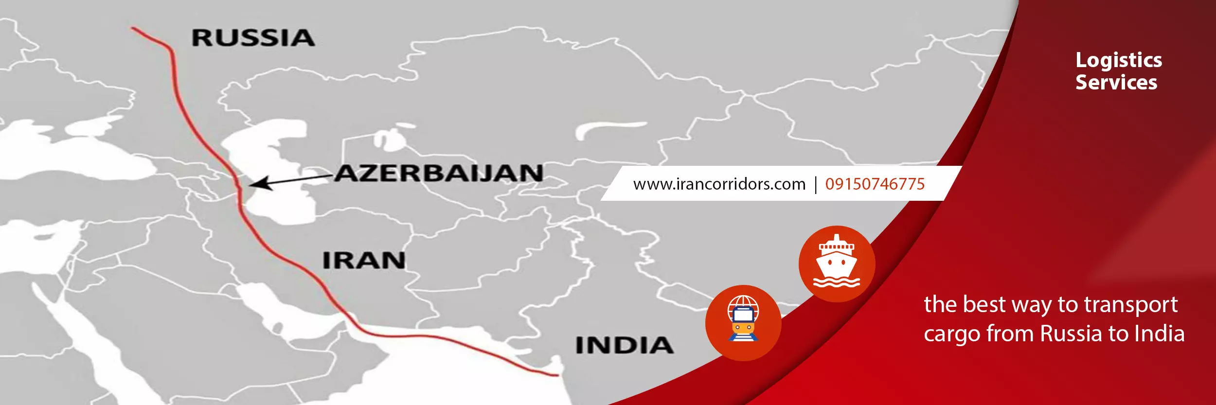
آسیای مرکزی به خلیج فارس از طریق ایران، در مقایسه با مسیر روسیه یا چین، عموماً کوتاهترین مسیر زمینی برای صادرکنندگان آسیای مرکزیِ محصور در خشکی است که به دنبال دسترسی به آبهای آزاد هستند.
For businesses focused specifically on this corridor, our dedicated guide on Transit to and from Turkmenistan via Iran covers border procedures, rail schedules, and documentation in more detail.
Route 2: Caucasus to Persian Gulf via Iran
Cargo from Armenia, Azerbaijan, and Georgia — and by extension from Russia and parts of Eastern Europe — enters Iran from the northwest, forming part of the broader International North-South Transport Corridor (INSTC).
- Key border crossings: Astara (Azerbaijan–Iran, both road and rail), Norduz (Armenia–Iran), Julfa
- Core infrastructure: The Rasht–Astara rail link, the missing segment that would complete a continuous north–south rail chain; until fully operational, this route relies on a rail-road combination.
- Best suited for: containerized general cargo and goods moving between Russia/Caucasus and South Asia via Iranian ports.
- Typical destination port: Bandar Abbas, with Chabahar as a secondary option for onward South Asian legs.
Route 3: Afghanistan/Pakistan-Linked Access via Iran
For landlocked Afghanistan and for Pakistani-origin cargo seeking an alternative to Karachi-based congestion, Iran offers a direct westward corridor.
- Key border crossings: Islam Qala/Dogharoun (Afghanistan–Iran), Milak–Zaranj, Mirjaveh (Pakistan–Iran)
- Core infrastructure: The Khaf–Herat railway (connecting Afghanistan to the Iranian rail network) and road corridors linking to both Bandar Abbas and Chabahar.
- Best suited for: Afghan transit trade seeking to reduce dependency on a single maritime gateway, and time-sensitive or lower-volume Pakistani-origin cargo.
- Typical destination port: Chabahar is frequently preferred here, since it was specifically developed to give Afghanistan (and India) a route that bypasses Pakistani territory.
Route 4: India-Linked Multimodal Options Using Iranian Ports
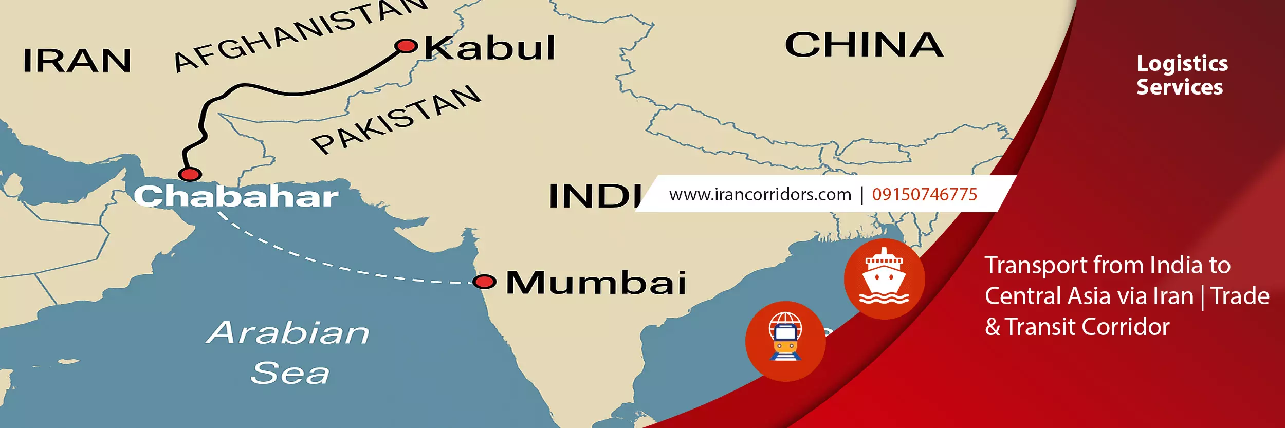
India does not share a land border with Iran, so this route is inherently multimodal: a sea leg from Indian ports (Mumbai, Kandla) to Chabahar, followed by road or rail onward into Afghanistan or Central Asia.
- Key infrastructure: Chabahar’s Shahid Beheshti terminal, plus onward road links toward Zaranj/Delaram in Afghanistan.
- Best suited for: Indian exporters/importers targeting Afghan and Central Asian markets without routing through Pakistan.
- Typical destination port: Chabahar, almost exclusively — this is the route’s entire strategic rationale.
Route 5: China/Central Eurasia West-South Connections via Iran
Western Chinese provinces increasingly use Central Asian rail links to reach Iran, forming a westward extension of Belt and Road-linked infrastructure toward the Persian Gulf.
- Key infrastructure: Rail corridors through Kazakhstan and/or Kyrgyzstan–Uzbekistan into Turkmenistan, then Sarakhs into Iran.
- Best suited for: Chinese manufactured goods and industrial cargo seeking an alternative to maritime routes through the Strait of Malacca, or to Gwadar-based options.
- Typical destination port: Bandar Abbas, for its container throughput and Gulf shipping line connections.
Bandar Abbas vs Chabahar: Choosing the Right Endpoint Port
One of the most common decision points in route planning is which Iranian port to use. The Chabahar vs Bandar Abbas transit route question depends heavily on origin, cargo type, and destination market.
| Factor | Bandar Abbas | Chabahar |
|---|---|---|
| Location | Strait of Hormuz, inside the Persian Gulf | Gulf of Oman, outside the Strait of Hormuz |
| Primary strength | Largest container/cargo throughput in Iran; dense shipping line network | Direct open-ocean access without transiting the Strait of Hormuz |
| Best linked routes | Central Asia, Caucasus, China corridors | Afghanistan, India-linked routes |
| Hinterland rail | More mature rail connectivity via Sarakhs | Growing, tied to Chabahar–Zahedan rail development |
| Typical cargo | Containers, bulk commodities, general cargo | Transit cargo for Afghanistan, India-origin multimodal shipments |
| Strategic role | General-purpose Gulf gateway | Purpose-built bypass route avoiding Pakistani transit |
Rule of thumb: if your cargo is moving to or from Central Asia, the Caucasus, or China, Bandar Abbas is usually the default. If your cargo involves Afghanistan or India specifically — or you need to avoid Strait of Hormuz-dependent routing — Chabahar is the more strategically relevant option.
Road, Rail, and Multimodal: Comparing Transport Modes
Route selection isn’t only about geography — it’s also about how cargo physically moves once inside Iran. This is where many multimodal routes to Persian Gulf via Iran outperform single-mode options.
| Mode | Strengths | Limitations | Best For |
|---|---|---|---|
| Road | Flexible, faster for smaller shipments, fewer transshipment points | Higher per-unit cost over long distances, more exposed to seasonal border delays | Time-sensitive, lower-volume, or irregular cargo |
| Rail | Lower cost per ton over long distances, higher capacity, more predictable scheduling | Fixed infrastructure, limited last-mile flexibility, dependent on gauge compatibility at some borders | Bulk commodities, large industrial shipments, Central Asia/Caucasus origins |
| Multimodal (sea-road-rail) | Combines strengths of each leg, essential where no land border exists (e.g., India) | More coordination and documentation complexity, more handoff points | India-linked cargo, mixed-origin consolidated shipments |
In general, overland access to Persian Gulf through Iran favors rail for bulk and lower-cost shipments, road for flexibility and speed, and multimodal combinations wherever a land bridge alone can’t complete the journey (as with India).
Key Factors in Choosing a Route
When comparing Persian Gulf transit routes via Iran, the right choice depends on weighing several variables together rather than optimizing for just one:
- Transit time: Rail is generally more predictable but not always faster than road for shorter distances.
- Cost structure: Rail typically wins on a per-ton basis for bulk cargo over long distances; road wins for smaller, urgent shipments.
- Cargo type: Bulk and industrial cargo favor rail-heavy corridors (Central Asia, China); time-sensitive or lower-volume cargo favors road-based flexibility.
- Border capacity and congestion: Some crossings (e.g., Sarakhs, Astara) have significantly higher throughput capacity than others, affecting reliability.
- Seasonality: Mountain-adjacent crossings in the Caucasus and parts of Central Asia can face winter slowdowns; this should factor into scheduling for Q4/Q1 shipments.
- Documentation and customs complexity: Multi-border routes (e.g., China–Central Asia–Iran) involve more customs regimes than single-border routes.
- Geopolitical and compliance risk: Sanctions exposure varies by cargo category and counterpart; this should be assessed on a shipment-by-shipment basis, ideally with compliance counsel, before committing to a route.
Which Route Fits Your Situation?
| If your cargo originates in… | Consider this route | Typical port | Typical mode |
|---|---|---|---|
| Uzbekistan, Kazakhstan, Turkmenistan | Central Asia corridor | Bandar Abbas | Rail |
| Armenia, Azerbaijan, Georgia, Russia | Caucasus/INSTC corridor | Bandar Abbas | Rail + road |
| Afghanistan | Afghanistan/Pakistan-linked corridor | Chabahar | Road + rail |
| India | India-linked multimodal route | Chabahar | Sea + road |
| Western China | China/Central Eurasia corridor | Bandar Abbas | Rail |
This is a starting framework, not a fixed rule — actual route selection should also account for current border conditions, seasonal factors, and the specific commodity being shipped.
Frequently Asked Questions
What are the main alternative transit routes to the Persian Gulf via Iran?
The primary corridors run from Central Asia, the Caucasus, Afghanistan/Pakistan, India (via sea-land multimodal transfer), and western China, each converging on either Bandar Abbas or Chabahar as the Gulf-facing endpoint.
Should I use Bandar Abbas or Chabahar for my shipment?
Bandar Abbas suits Central Asia, Caucasus, and China-linked cargo due to its shipping density and rail connectivity. Chabahar is the better fit for Afghanistan-linked and India-linked cargo, particularly where avoiding Pakistani transit is a priority.
Is rail or road better for transit through Iran?
راه آهن معمولاً هزینههای کمتری برای هر تن بار فله و مسافتهای طولانی ارائه میدهد، در حالی که جاده انعطافپذیری و سرعت بیشتری را برای محمولههای کوچکتر یا حساس به زمان ارائه میدهد. بسیاری از مسیرها از ترکیبی از هر دو استفاده میکنند.
این مسیرها چه ارتباطی با INSTC دارند؟
کریدور قفقاز و بخشهایی از کریدور آسیای مرکزی، بخشهایی از کریدور حمل و نقل بینالمللی شمال-جنوب را تشکیل میدهند که یک شبکه چندوجهی در حال تکامل است و روسیه و اروپای شمالی را از طریق ایران به خلیج فارس و آسیای جنوبی متصل میکند.
آیا این مسیرها تحت تأثیر تحریمهای بینالمللی قرار گرفتهاند؟
میزان قرار گرفتن در معرض تحریمها بسته به نوع محموله، مبدا/مقصد و طرفهای درگیر متفاوت است. این موضوع باید قبل از نهایی کردن تصمیم در مورد مسیر، مورد به مورد با مشاوره انطباق با تجارت واجد شرایط ارزیابی شود.
برنامه ریزی مسیر شما؟
انتخاب بین این کریدورها به جزئیات خاص محموله، جدول زمانی و بازار مبدا شما بستگی دارد – عواملی که این راهنما میتواند به تنهایی آنها را شرح دهد اما به طور کامل آنها را حل نمیکند. اگر در حال ارزیابی این هستید که کدام ترکیب مسیر، بندر و روش حمل و نقل برای محموله شما مناسب است، [درخواست ارزیابی مسیر] را از تیم ما دریافت کنید تا مقایسهای متناسب با مبدا و مشخصات محموله خاص شما انجام شود.